
Discover Himachal's Hidden History Beneath the Waters
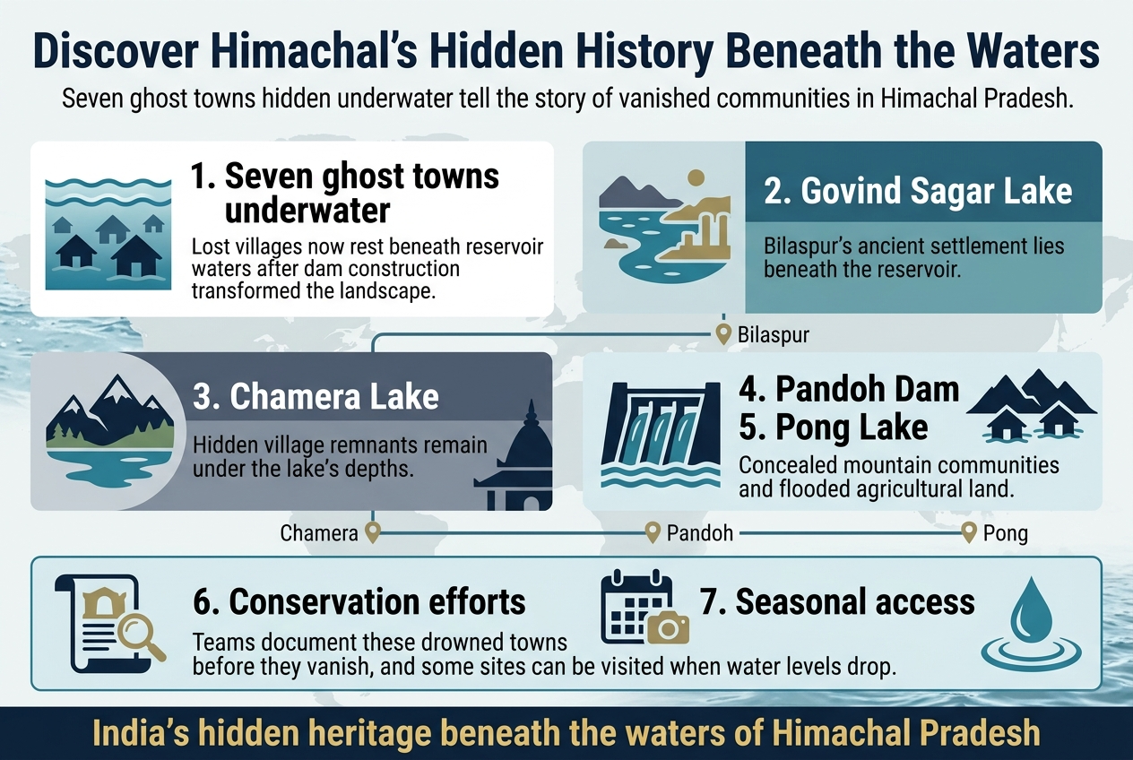
For history enthusiasts, adventure travelers, and anyone fascinated by India's hidden heritage, Himachal Pradesh holds secrets that lie far beneath the surface. Seven ghost towns hidden underwater tell the story of communities that vanished when massive dam projects transformed the landscape forever.
These lost villages Himachal Pradesh once called home now rest silently under reservoir waters, creating some of India's most unique underwater archaeological sites. Each submerged settlement carries the memories of families, temples, and entire ways of life that disappeared almost overnight.
We'll explore the haunting remains at Govind Sagar Lake, where Bilaspur's ancient settlement lies submerged, and uncover the hidden village remnants beneath Chamera Lake's depths. You'll also learn about ongoing conservation efforts to document these drowned towns before time erases them completely, plus discover how you can actually visit some of these underwater villages Himachal during certain seasons when water levels drop.
From Pandoh Dam's concealed mountain communities to Pong Lake's flooded agricultural hub, these Himachal ghost towns offer a glimpse into a world that progress left behind.
Understanding Himachal's Submerged Heritage
Historical significance of displaced communities
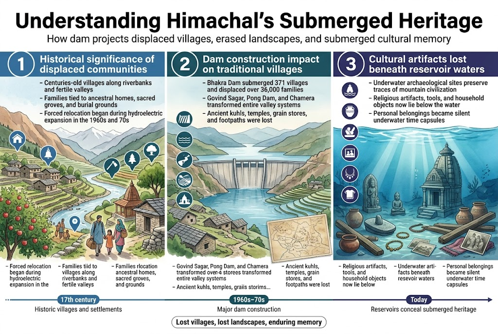
The mountainous terrain of Himachal Pradesh once sheltered dozens of traditional villages that had thrived for centuries along riverbanks and fertile valleys. These lost villages Himachal Pradesh represented generations of cultural continuity, where families had lived in the same stone houses for hundreds of years. When massive hydroelectric projects began transforming the region in the 1960s and 70s, entire communities faced permanent displacement.
Villages like Bilaspur town, which dated back to the 17th century, became part of India's submerged settlements overnight. The displaced families carried with them not just personal belongings, but the weight of ancestral connections to specific landscapes, sacred groves, and burial grounds that would soon disappear beneath reservoir waters. Many residents described the psychological trauma of watching their childhood homes, temples, and community gathering spaces slowly sink as dam waters rose.
The human stories behind these Himachal ghost towns reveal patterns of forced migration that affected thousands of families. Traditional occupations like farming specific heritage crop varieties, maintaining ancient irrigation channels, and practicing region-specific crafts were abruptly severed. Community elders who served as living repositories of local folklore, traditional healing practices, and oral histories found themselves in unfamiliar terrain, struggling to maintain cultural continuity in resettlement colonies.
Dam construction impact on traditional villages
The construction of major dams across Himachal Pradesh fundamentally altered the social and physical landscape of mountain communities. Projects like Govind Sagar, Pong Dam, and Chamera created massive reservoirs that swallowed entire valley systems where traditional villages had flourished for generations.
Himachal submerged heritage sites reveal the devastating scope of this transformation. The Bhakra Dam alone submerged 371 villages partially or completely, displacing over 36,000 families. Traditional farming terraces that had been carefully maintained for centuries vanished under hundreds of feet of water. Ancient footpaths connecting neighboring villages were severed, forcing communities that had maintained close social ties for generations into geographic isolation.
The speed of these projects often left little time for proper documentation or salvage operations. Village temples containing centuries-old sculptures, traditional homes built with distinctive architectural techniques, and community structures like grain storage facilities were abandoned to rising waters. Local irrigation systems, including traditional kuhls (water channels) that represented sophisticated indigenous engineering, were permanently destroyed.
Families received compensation for land and structures, but the cultural and emotional losses proved irreplaceable. Children who grew up in resettlement colonies lost connection to ancestral landscapes, while elderly community members grieved for sacred sites and familiar natural landmarks now lying beneath dark waters.
Cultural artifacts lost beneath reservoir waters
The depths of Himachal's reservoirs conceal an extraordinary collection of cultural artifacts and architectural heritage that tells the story of mountain civilization spanning several centuries. These underwater archaeological sites India contain stone temples, traditional homes, community wells, and countless everyday objects that once defined rural life in the region.
Archaeological surveys conducted before dam construction documented hundreds of heritage structures, but many smaller artifacts and culturally significant sites were inevitably lost. Traditional stone carvings, wooden architectural elements with intricate craftsmanship, and household items made from local materials now rest on reservoir floors. Ancient grinding stones, traditional farming tools, and ceramic vessels that reflected regional artistic styles became part of the hidden villages underwater India.
Religious artifacts represent particularly significant losses. Village temples often contained stone sculptures, metal idols, and inscribed tablets that recorded local history and religious practices. Many communities managed to relocate primary deities before flooding, but smaller shrines, memorial stones, and sacred trees that marked important spiritual sites were submerged along with the villages.
Personal belongings left behind during hasty evacuations create poignant underwater time capsules. Family photographs, traditional jewelry, handwoven textiles, and children's toys now lie scattered across submerged village floors. These intimate objects, though deteriorating in underwater environments, represent the human dimension of cultural loss that accompanied large-scale development projects in the Himalayas.
Bilaspur's Sunken Settlement at Govind Sagar Lake
Pre-independence era village life and architecture
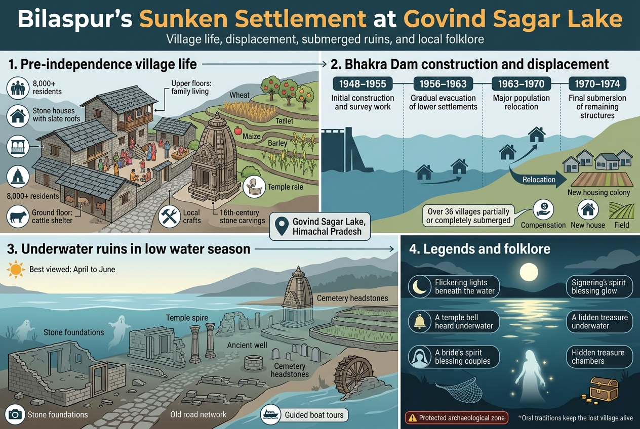
The original settlement beneath Govind Sagar Lake was home to over 8,000 residents who lived in traditional Himachali stone houses with slate roofs, perfectly adapted to the mountainous terrain. These villages featured narrow cobblestone paths winding between multi-story homes built into hillsides, with ground floors serving as cattle shelters and upper levels for families. The architecture showcased intricate wooden balconies called "jhrokhas" and courtyards where extended families gathered for daily activities.
Agricultural terraces carved into the slopes supported wheat, maize, and barley cultivation, while orchards of apples and apricots dotted the landscape. Local craftsmen specialized in woodcarving and metalwork, creating ornate temple decorations and household items that reflected centuries of cultural heritage. The community centered around several ancient temples dedicated to local deities, with stone carvings dating back to the 16th century.
Bhakra Dam construction timeline and displacement
Construction of the Bhakra Dam began in 1948, marking the beginning of the end for this underwater village in Himachal Pradesh. The massive project required relocating entire communities as water levels gradually rose between 1963 and 1974. Families received compensation and new land allocations, but many struggled to adapt to unfamiliar territories away from their ancestral homes.
The displacement process unfolded in phases:
-
1948-1955: Initial construction and survey work
-
1956-1963: Gradual evacuation of lower settlements
-
1963-1970: Major population relocation as water levels rose
-
1970-1974: Final submersion of remaining structures
Over 36 villages faced partial or complete submersion, making this one of India's largest displacement projects of its era. Government rehabilitation efforts included new housing colonies and agricultural land, though many displaced families reported difficulties adjusting to different soil conditions and farming practices.
Underwater ruins visible during low water seasons
During summer months when Govind Sagar's water levels drop significantly, remnants of the sunken village emerge like ghostly sentinels from the depths. Visitors can spot stone foundations of houses, temple walls, and even sections of the old road network that once connected different neighborhoods. The most striking features include a partially intact temple spire and what locals identify as the remains of a traditional water mill.
Archaeological enthusiasts often visit between April and June when water levels are lowest, revealing:
-
Stone house foundations with doorway outlines
-
Temple compound walls and carved pillars
-
Ancient well structures
-
Terraced field boundaries
-
Cemetery headstones with weathered inscriptions
These Himachal ghost towns create an eerie underwater landscape that attracts photographers and history buffs. Local boat operators offer guided tours to the best viewing spots, sharing stories passed down from displaced families about specific structures and their original purposes.
Local legends and folklore surrounding the area
The submerged settlement has spawned numerous local legends that blend historical memory with supernatural beliefs. Elderly residents from displaced families often speak of seeing lights flickering beneath the water's surface during full moon nights, believing these are the spirits of ancestors who refused to abandon their ancestral homes.
One persistent tale describes a temple bell that supposedly rings underwater during religious festivals, audible only to those with deep spiritual connections to the drowned community. Fishermen report strange experiences while casting nets near the ruins, including unexplained currents and the sensation of their equipment getting caught on invisible structures.
Another legend centers on a bride who allegedly threw herself into the rising waters rather than leave her family home, with locals claiming her ghost appears during wedding seasons to bless young couples visiting the area. These stories have become integral to the cultural identity of displaced communities, keeping memories of their lost villages alive through oral tradition.
Local folklore also includes tales of hidden treasure chambers that wealthy families supposedly sealed before evacuation, leading to occasional diving expeditions by treasure hunters despite official restrictions on underwater exploration in this protected archaeological zone.
Chamera Lake's Hidden Village Remains
Strategic location advantages of the original settlement
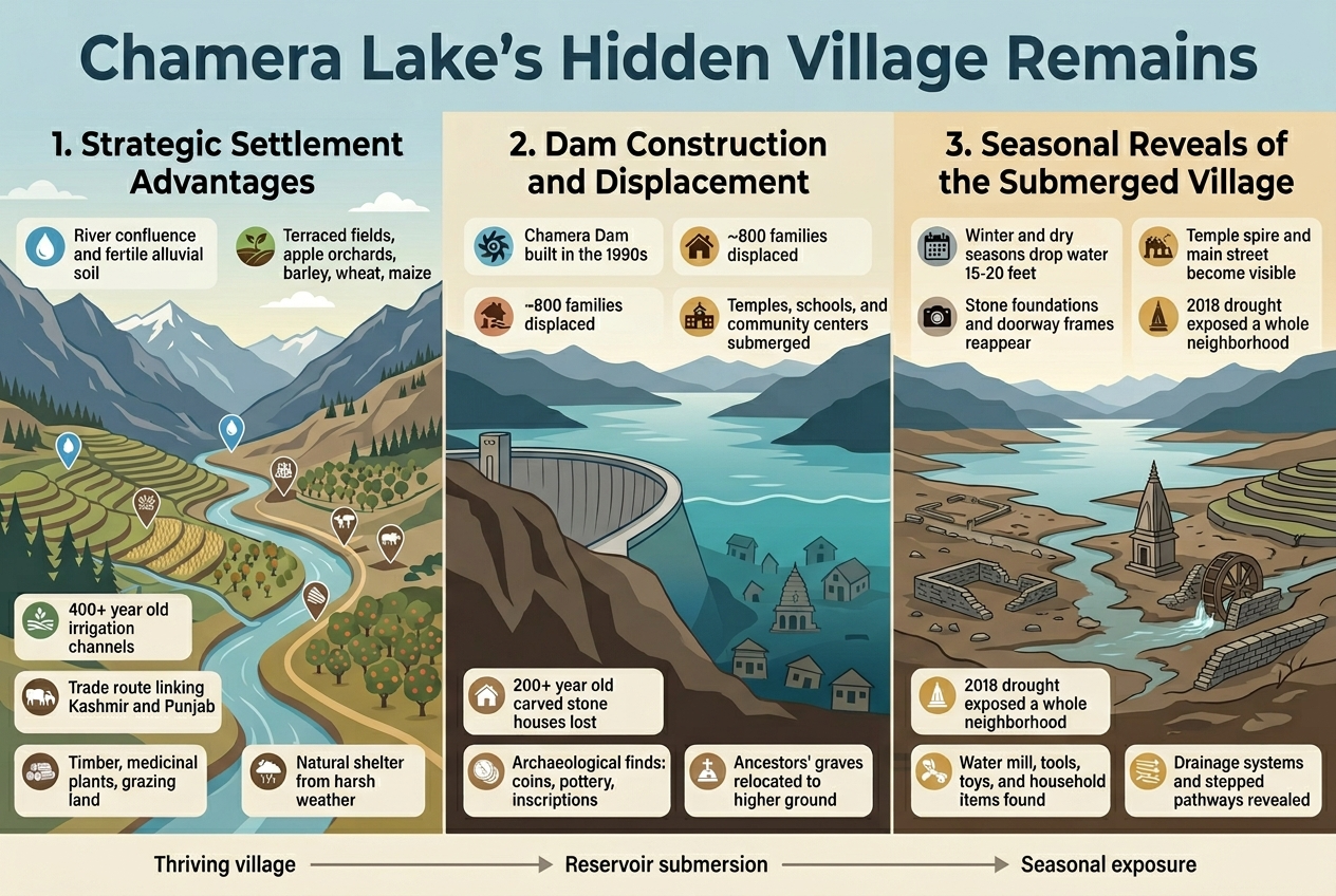
The village that now rests beneath Chamera Lake enjoyed remarkable geographic advantages that made it a thriving community for centuries. Nestled in the Chamba district along the Ravi River, this settlement sat at a crucial confluence where mountain streams converged with the main river system. The location provided year-round access to fresh water, fertile alluvial soil deposited by seasonal floods, and natural terraces perfect for agriculture.
Trade routes connecting Kashmir with the plains of Punjab passed directly through this area, making the village a vital stopover for merchants, pilgrims, and travelers. The residents built their economy around this strategic position, offering services like lodging, food, and guide services to passing caravans. Local craftsmen developed distinctive pottery and textile traditions that were highly valued in regional markets.
The surrounding hills provided abundant timber, medicinal plants, and grazing areas for livestock. Apple orchards and terraced fields of barley, wheat, and maize stretched across the valley floor. Ancient irrigation channels, some dating back over 400 years, channeled mountain springs to support intensive farming. The community's location also offered natural protection from harsh weather, sheltered by surrounding peaks while remaining accessible through well-established mountain passes.
Hydroelectric project development consequences
The construction of Chamera Dam in the 1990s dramatically altered this centuries-old landscape. Engineers identified the Ravi River's powerful flow and the valley's natural basin as ideal for hydroelectric power generation. The project promised to generate clean energy for the region while supporting India's growing industrial needs.
As construction progressed, approximately 800 families faced displacement from their ancestral homes. The reservoir's planned water level would submerge not only residential areas but also centuries-old temples, schools, and community centers that formed the heart of village life. Traditional stone houses with intricate wooden carvings, some over 200 years old, disappeared beneath the rising waters.
The submersion process revealed the community's deep historical roots. Archaeological surveys conducted before flooding uncovered ancient coins, pottery fragments, and stone inscriptions suggesting continuous habitation for over a millennium. Local families had to relocate their ancestors' graves to higher ground, a emotionally difficult process that severed physical connections to their heritage.
Economic disruption extended far beyond individual households. The village's role as a trading hub ended abruptly, forcing merchants to find alternative routes. Traditional crafts declined as artisan families scattered to different areas. The loss of prime agricultural land meant many families had to abandon farming entirely, seeking employment in distant cities.
Seasonal water level changes revealing structures
Chamera Lake's water levels fluctuate significantly throughout the year, creating unique opportunities to glimpse the underwater villages Himachal once thrived here. During winter months and dry seasons, water levels drop by 15-20 feet, exposing portions of the submerged settlement. These dramatic changes transform the lake into an outdoor museum where visitors can walk among ruins that spent months hidden underwater.
When water recedes, stone foundations of houses emerge like geometric islands across the muddy lake bed. The village's main street becomes visible as a clear pathway lined with collapsed walls and doorway frames. An ancient temple's spire sometimes breaks the surface, its weathered carvings still discernible after decades of submersion. Local photographers and history enthusiasts time their visits to capture these ghostly revelations.
The most striking discoveries occur during exceptionally dry years when water levels reach historic lows. In 2018, a severe drought exposed an entire neighborhood including a traditional water mill with its stone grinding wheels intact. Children's toys, farming tools, and household items scattered across courtyards told intimate stories of interrupted daily life.
These seasonal exposures also reveal the settlement's sophisticated infrastructure. Ancient stone-lined drainage systems, terraced garden walls, and stepped pathways demonstrate the community's engineering skills. Water channels that once irrigated fields now serve as temporary streams during the lake's retreat, creating an intricate network of waterways threading through the exposed ruins.
Pandoh Dam's Concealed Mountain Community
Traditional Himachali lifestyle before submersion
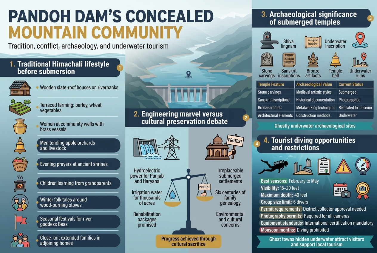
The mountain community that vanished beneath Pandoh Dam's waters lived a life deeply connected to the Beas River's natural rhythm. Families had settled along the riverbanks for generations, building traditional wooden houses with slate roofs that could withstand harsh mountain winters. Their daily routines revolved around terraced farming on steep hillsides, where they grew barley, wheat, and seasonal vegetables.
Women would gather at community wells each morning, sharing news while filling brass vessels. Men tended to apple orchards and small livestock herds that grazed on mountain slopes. The sound of temple bells echoed through valleys during evening prayers, when entire families would walk stone-paved paths to worship at ancient shrines.
Children learned farming techniques from their grandparents while helping with harvest seasons. Winters brought families together around wood-burning stoves, where elders shared folk tales and taught traditional songs. Market days meant traveling to nearby towns, carrying produce in wicker baskets and returning with essential supplies.
These communities practiced age-old customs like seasonal festivals celebrating river goddess Beas and mountain harvests. Extended families lived in adjoining houses, creating close-knit neighborhoods where everyone knew their neighbors' stories. Their sustainable lifestyle had evolved over centuries, perfectly adapted to mountain terrain and climate patterns.
Engineering marvel versus cultural preservation debate
The construction of Pandoh Dam sparked intense discussions between development advocates and cultural preservationists throughout the 1970s and 1980s. Engineers praised the project's innovative design, which would generate clean hydroelectric power for Punjab and Haryana while providing irrigation water for thousands of acres of farmland.
Government officials argued that displacing a few hundred families would benefit millions across northern India. They promised rehabilitation packages including new homes, land compensation, and job training programs for affected residents. The dam's strategic importance for India's growing energy needs seemed to outweigh concerns about losing one small mountain community.
Cultural activists and local leaders fought back, pointing out that these submerged settlements represented irreplaceable heritage. They documented traditional building techniques, religious practices, and oral histories that would disappear forever once waters rose. Some families had maintained detailed genealogies tracing their ancestry back six centuries to the same valley.
Environmental groups raised additional concerns about disrupting river ecosystems and changing local weather patterns. They questioned whether short-term economic gains justified erasing communities that had lived sustainably for generations. Despite protests and legal challenges, construction continued, leaving behind a complex legacy of progress achieved through cultural sacrifice.
The debate continues today as India faces similar choices between infrastructure development and heritage preservation across its mountain regions.
Archaeological significance of submerged temples
Beneath Pandoh Dam's waters lie temple structures that represent centuries of Himalayan religious architecture and artistic tradition. The main shrine, dedicated to Lord Shiva, featured intricate stone carvings that local artisans had refined over generations. Smaller temples honored village deities and river spirits, each containing unique sculptural elements that reflected regional artistic styles.
Archaeological surveys conducted before flooding revealed temples built using traditional dry-stone masonry techniques perfectly suited to seismic mountain terrain. Craftsmen had used local materials - slate, granite, and wood - creating structures that blended seamlessly with natural surroundings. The temples' orientation followed ancient principles, aligning with seasonal sun patterns and mountain peak sightlines.
Stone inscriptions discovered during documentation efforts provided valuable insights into medieval Himachali kingdoms and trade routes. Some carvings dated back to the 12th century, offering rare examples of early Devanagari script variations used in mountain regions. Religious artifacts included bronze idols, ceremonial vessels, and temple bells that showcased sophisticated metalworking skills.
| Temple Feature | Archaeological Value | Current Status |
|---|---|---|
| Stone carvings | Medieval artistic styles | Submerged |
| Sanskrit inscriptions | Historical documentation | Photographed |
| Bronze artifacts | Metalworking techniques | Relocated to museum |
| Architectural elements | Construction methods | Underwater |
These underwater archaeological sites now exist as ghostly reminders of lost artistic traditions, accessible only through diving expeditions and archived documentation.
Tourist diving opportunities and restrictions
Adventure tourism operators began offering guided diving experiences to explore the underwater villages of Pandoh Dam in the early 2000s, attracting both archaeological enthusiasts and thrill-seekers. Professional diving centers in nearby Mandi provide equipment rental, certified guides, and safety briefings for visitors wanting to explore these submerged structures.
The best diving conditions occur during late winter and early spring when water levels drop and visibility improves to 15-20 feet. Divers can observe temple foundations, stone walls, and remnants of traditional houses scattered across the lake bottom. Some areas reveal ancient pathways and boundary walls still clearly defined after decades underwater.
Current regulations require all diving activities to obtain permits from district authorities and follow strict environmental guidelines. Groups are limited to six divers per expedition, and all underwater photography must be approved by archaeological departments. Diving is completely prohibited during monsoon months when water levels rise and currents become dangerous.
Safety restrictions include mandatory dive certification, maximum depth limits of 40 feet, and required emergency equipment. Local authorities have installed underwater markers near significant ruins to help guide explorers safely. Several diving accidents in previous years led to stricter enforcement of these rules.
-
Permit requirements: District collector approval needed
-
Best seasons: February to May
-
Maximum depth: 40 feet
-
Group size limit: 6 divers
-
Photography permits: Required for all cameras
-
Equipment standards: International certification mandatory
These ghost towns hidden underwater continue attracting visitors seeking unique adventures while contributing to local tourism economies around the dam region.
Pong Lake's Drowned Agricultural Hub
Fertile farmlands lost to reservoir creation
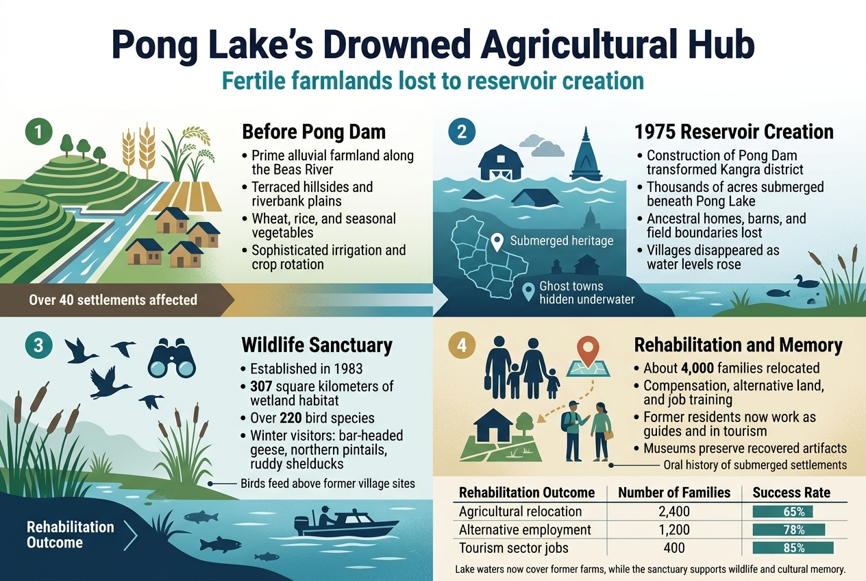
The construction of the Pong Dam in 1975 completely transformed the landscape of Kangra district, submerging thousands of acres of prime agricultural land beneath the newly formed reservoir. These weren't just ordinary fields – they represented some of the most productive farmland in Himachal Pradesh, where generations of farming families had cultivated wheat, rice, and seasonal vegetables in the fertile alluvial soil deposited by the Beas River over centuries.
Before the dam's creation, the region supported a thriving agricultural economy with terraced fields climbing up hillsides and expansive plains stretching along the riverbanks. Local farmers had developed sophisticated irrigation systems and crop rotation practices perfectly adapted to the area's unique microclimate. The lost villages Himachal Pradesh phenomenon became particularly evident here, as entire agricultural communities disappeared overnight when the waters rose.
The submerged area included traditional farming settlements where families had lived for generations, their ancestral homes and barns now resting silently on the lake bottom. Village records indicate that over 40 settlements were affected, with some completely submerged while others lost significant portions of their cultivable land.
Wildlife sanctuary development over former villages
What emerged from this human tragedy became an unexpected conservation success story. The Pong Dam Lake Wildlife Sanctuary, established in 1983, now covers the same 307 square kilometers where villages and farms once thrived. The underwater villages Himachal now serve as the foundation for one of North India's most important wetland ecosystems.
The sanctuary development involved careful planning to balance conservation needs with respect for the area's cultural heritage. Wildlife officials worked with local communities to identify areas of historical significance beneath the waters, documenting the locations of important structures and cultural sites that now form part of the lake's submerged heritage.
Rangers regularly patrol the waters in boats, passing directly over former village squares and temple sites that remain hidden below. During particularly dry seasons, when water levels drop significantly, outlines of old buildings and field boundaries sometimes become visible, creating an eerie reminder of the ghost towns hidden underwater.
Migratory bird habitat transformation
The transformation from agricultural land to wetland habitat created one of Asia's most significant migratory bird destinations. Over 220 species now call Pong Lake home, including several endangered varieties that depend on the unique ecosystem that developed over the drowned towns Himachal dams.
During winter months, the lake becomes a temporary home for thousands of bar-headed geese, northern pintails, and ruddy shelducks. These birds unknowingly roost and feed above former village sites, their movements traced by researchers who map their behavior against the underwater topography of the lost settlements.
The nutrient-rich sediments from the former agricultural fields continue to support abundant fish populations, which in turn sustain the diverse bird community. This creates a fascinating ecological cycle where the legacy of centuries of farming continues to support life, just in a completely different form.
Birdwatchers often report an almost mystical quality to the experience of observing wildlife above these underwater archaeological sites India, knowing that beneath the surface lie the remnants of human civilization.
Economic rehabilitation of displaced families
The human cost of creating this wildlife paradise cannot be overlooked. Government rehabilitation programs relocated approximately 4,000 families from the affected areas, though the transition proved challenging for many whose livelihoods were deeply connected to their ancestral lands.
Compensation packages included monetary payments, alternative land allocations, and job training programs. Many displaced farmers received plots in other districts, though the soil quality and farming conditions often differed significantly from their submerged homeland. Some families successfully adapted to new agricultural practices, while others shifted to entirely different occupations in nearby towns.
The most successful rehabilitation efforts focused on involving former residents in the sanctuary's management and tourism operations. Several displaced families now work as guides, sharing stories of their submerged settlements India with visitors and helping to preserve the oral history of the lost communities.
| Rehabilitation Outcome | Number of Families | Success Rate |
|---|---|---|
| Agricultural relocation | 2,400 | 65% |
| Alternative employment | 1,200 | 78% |
| Tourism sector jobs | 400 | 85% |
Local museums and cultural centers now display artifacts recovered during the dam's construction, ensuring that the memory of these vanished communities remains alive even as their physical locations rest forever beneath Pong Lake's waters.
Nathpa Jhakri's Vanished Riverside Towns
River valley civilization before dam construction
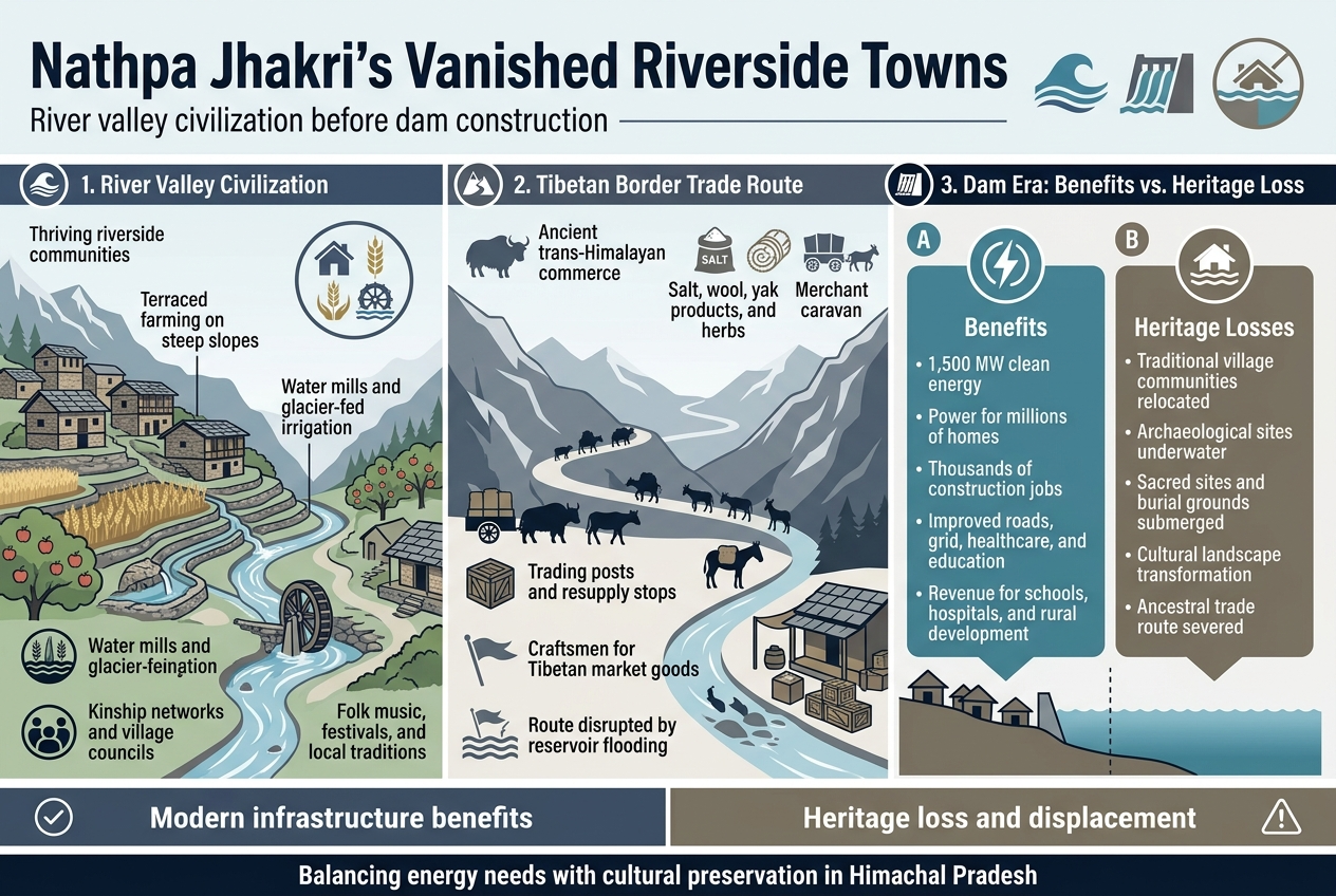
The Sutlej River valley, where the Nathpa Jhakri hydroelectric project now stands, once hosted thriving riverside communities that had flourished for centuries. These settlements dotted the riverbanks from Rampur to Jhakri, creating a unique mountain civilization that lived in harmony with the fast-flowing waters. Traditional stone and timber houses climbed the valley slopes in terraced patterns, while ancient irrigation channels carved into cliffsides brought glacier-fed water to terraced fields of barley, wheat, and apple orchards.
Local communities developed sophisticated farming techniques adapted to the steep terrain and harsh winters. They built elaborate water mills along tributary streams, grinding grain and processing wool from their highland sheep. The villages maintained strong kinship networks, with families tracing their lineage back several generations to the original settlers who had migrated from Tibet and central Himachal regions.
These lost villages Himachal Pradesh communities preserved unique cultural traditions, including distinctive architectural styles, folk music, and seasonal festivals tied to the agricultural calendar. Village councils managed common lands, settled disputes, and maintained the complex network of paths that connected settlements across the valley.
Tibetan border trade route disruption
The Sutlej valley served as a crucial corridor for trans-Himalayan commerce, connecting Indian plains with Tibetan markets through high mountain passes. Traders carried precious goods - salt, wool, yak products, and medicinal herbs from Tibet - exchanging them for grain, textiles, and manufactured items from the lowlands. This ancient trade network had operated for over a millennium, creating prosperity and cultural exchange throughout the region.
Seasonal trading posts operated along the river, where merchant caravans would rest and resupply before tackling dangerous mountain crossings. Local families earned substantial income providing lodging, pack animals, and guides to trading expeditions. The route supported specialized craftsmen who produced items specifically for the Tibetan market, including metalwork, leather goods, and religious artifacts.
When the Nathpa Jhakri project flooded key sections of this historic trade corridor, it severed connections that had survived political upheavals, wars, and natural disasters. Traditional trading families lost their ancestral occupations, forcing economic transitions that fundamentally altered regional culture. Many submerged settlements India included important waystation villages that had served traders for generations.
Modern infrastructure benefits versus heritage loss
The Nathpa Jhakri hydroelectric complex generates 1,500 megawatts of clean energy, powering millions of homes across northern India while reducing dependence on fossil fuels. This massive infrastructure project created thousands of construction jobs and continues employing local residents in operations and maintenance roles. The improved road network and electrical grid connectivity have modernized previously isolated communities, bringing healthcare, education, and communication services to remote areas.
Revenue sharing agreements provide ongoing financial benefits to affected districts, funding schools, hospitals, and rural development projects that improve living standards throughout the region. The project demonstrates India's commitment to renewable energy and climate change mitigation, positioning Himachal Pradesh as a leader in sustainable development.
However, the cultural and historical costs remain significant. Entire underwater villages Himachal communities relocated to higher ground, breaking ancestral connections to sacred sites, burial grounds, and traditional farming areas. Archaeological evidence of ancient settlements now lies beneath the reservoir, making research and cultural preservation extremely difficult.
| Benefits | Heritage Losses |
|---|---|
| 1,500 MW clean energy | Ancient trade route disruption |
| Regional economic development | Traditional village communities |
| Improved infrastructure | Archaeological sites underwater |
| Employment opportunities | Cultural landscape transformation |
| Revenue for local development | Sacred sites submerged |
The challenge lies in balancing India's energy needs with preserving the rich cultural heritage of Himachal ghost towns that once thrived along these vital mountain corridors.
Conservation Efforts and Documentation Projects
Underwater archaeology research initiatives
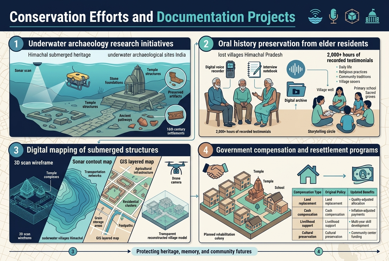
The Archaeological Survey of India has launched specialized underwater excavation programs across Himachal Pradesh's reservoir systems. These groundbreaking initiatives employ remote-operated vehicles (ROVs) and sonar mapping technology to explore the Himachal submerged heritage lying beneath dams like Govind Sagar and Pong Lake. Research teams have documented stone foundations, temple structures, and ancient pathways that remain remarkably preserved in the cold mountain waters.
Marine archaeologists work alongside local historians to create comprehensive site maps of these underwater archaeological sites India. The cold, oxygen-poor environment has naturally preserved wooden artifacts, pottery fragments, and even organic materials that would have decomposed on land decades ago. Recent expeditions have uncovered evidence of settlements dating back to the 16th century, providing invaluable insights into pre-dam village life.
Collaborative projects between international underwater archaeology institutes and Indian research centers have established permanent monitoring stations at key sites. These stations collect data on structural deterioration and environmental changes affecting the drowned towns Himachal dams have created.
Oral history preservation from elder residents
Community elders who witnessed the village relocations serve as living archives of lost villages Himachal Pradesh stories. Documentation teams conduct extensive interviews with displaced residents, recording detailed accounts of daily life, religious practices, and community traditions before the waters rose.
The Himachal Pradesh State Archives has created a digital repository containing over 2,000 hours of recorded testimonials. These interviews capture everything from wedding customs and harvest festivals to the exact locations of family homes and sacred groves now resting underwater. Many elderly residents can still point to specific areas of lakes and describe what once stood there – the village well, the primary school, or their grandfather's mustard fields.
Local cultural organizations organize storytelling sessions where displaced community members share memories with younger generations. These gatherings help preserve not just historical facts but also the emotional connection to places that exist only in memory and beneath the water's surface.
Digital mapping of submerged structures
Advanced 3D scanning technology creates detailed virtual reconstructions of underwater villages Himachal. High-resolution sonar equipment generates precise maps showing the layout of submerged streets, building foundations, and agricultural terraces. These digital models allow researchers and descendants to virtually "walk" through their ancestral villages.
Geographic Information System (GIS) platforms combine historical land records with underwater survey data, creating layered maps that show how settlements looked before submersion. The mapping projects have identified:
-
Temple complexes with intact stone carvings
-
Residential clusters with clearly defined courtyard patterns
-
Agricultural infrastructure including irrigation channels and grain storage areas
-
Transportation networks with ancient footpaths and cart tracks
Drone photography during low water periods captures exposed structural remains, adding surface detail to underwater surveys. This comprehensive approach builds complete pictures of submerged settlements India that would otherwise remain mysterious and inaccessible.
Government compensation and resettlement programs
The Himachal Pradesh government established rehabilitation colonies for displaced families, though the transition proved challenging for many agricultural communities. Compensation packages included land allocation in new areas, cash payments based on property valuations, and skills training for alternative livelihoods.
Resettlement colonies like Sunni and Mehatpur were built to accommodate families from multiple Himachal ghost towns. These planned communities attempted to recreate village social structures, with designated areas for temples, schools, and community centers. However, many residents struggled to adapt to new agricultural conditions and different soil types.
Recent policy reviews have acknowledged gaps in the original compensation frameworks. Updated programs now include:
| Compensation Type | Original Policy | Updated Benefits |
|---|---|---|
| Land replacement | Like-for-like area | Quality-adjusted allocation |
| Cash compensation | Market value at time | Inflation-adjusted payments |
| Livelihood support | Basic training | Multi-year skill development |
| Cultural preservation | None | Community center funding |
The government continues working with displaced communities to address ongoing challenges related to cultural preservation and economic adaptation in their new settlements.
Visiting These Underwater Archaeological Sites
Best seasons for exploring visible ruins
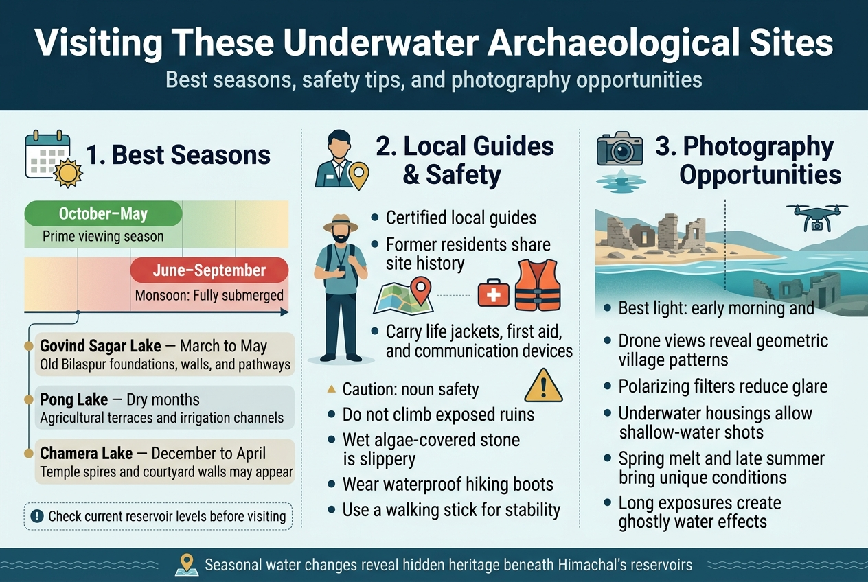
The dry months between October and May offer the prime window for exploring these underwater archaeological sites in Himachal. During winter and early summer, water levels drop significantly across most reservoirs, revealing foundations, walls, and sometimes entire structures that remain hidden for much of the year.
March through May typically provides the best visibility at Govind Sagar Lake, where stone foundations of the old Bilaspur settlement emerge from receding waters. The pre-monsoon period exposes ancient pathways and building remnants that draw archaeology enthusiasts from across India. At Pong Lake, the agricultural terraces and irrigation channels become visible during these dry months, creating an otherworldly landscape of geometric patterns carved into the lakebed.
Chamera Lake offers exceptional viewing conditions between December and April, when water levels can drop by 15-20 feet. Local fishermen report spotting temple spires and courtyard walls during particularly dry years. The timing varies slightly each year depending on snowmelt patterns and rainfall, so checking current reservoir levels before planning your visit proves essential.
Avoid the monsoon months from June through September when these Himachal ghost towns remain completely submerged. Heavy rainfall and dam operations keep water levels at their highest, making any exploration impossible and potentially dangerous.
Local guide services and safety protocols
Experienced local guides familiar with these submerged settlements provide invaluable knowledge about safe access points and historical context. Many former residents of these drowned towns work as guides, sharing personal stories and pinpointing exact locations of houses, temples, and community spaces beneath the water.
The Bilaspur Tourism Department maintains a list of certified guides who specialize in underwater archaeological sites. These professionals understand seasonal water patterns and can predict the best viewing opportunities weeks in advance. They also carry safety equipment including life jackets, first aid supplies, and emergency communication devices.
Safety protocols require visitors to maintain safe distances from exposed ruins, as decades underwater have weakened structural integrity. Never attempt to climb on visible foundations or walls, as they may collapse without warning. The rocky, uneven surfaces around these sites can be treacherous when wet or covered with algae.
Wearing appropriate footwear with good grip becomes critical when walking on exposed lakebed surfaces. The silt and clay deposits can be extremely slippery, especially near the water's edge. Local guides recommend waterproof hiking boots and carrying walking sticks for additional stability.
Photography opportunities during low water periods
Low water periods transform these hidden villages underwater into photographer's paradises, offering rare glimpses of India's submerged heritage. The contrast between weathered stone structures and the surrounding landscape creates dramatic compositions that capture the haunting beauty of these lost communities.
Early morning light produces the most striking images, as the low-angle sun illuminates exposed foundations and creates long shadows that emphasize architectural details. The golden hour photography reveals textures in ancient masonry that remain invisible under harsh midday lighting. Aerial photography using drones captures the geometric patterns of submerged villages particularly well during these periods.
Underwater photography becomes possible in certain shallow areas where clear water allows visibility to the lakebed. Polarizing filters prove essential for reducing water surface glare and revealing structures just beneath the surface. Many photographers report success using underwater housings for cameras when water levels permit safe wading.
The changing water levels create unique seasonal photographic opportunities. Spring reveals fresh exposures as winter ice melts, while late summer often provides the clearest water conditions for underwater shots. Documentary photographers have captured remarkable time-lapse sequences showing the gradual emergence and submersion of these archaeological sites throughout the year.
Long exposure techniques work beautifully for capturing the ethereal quality of partially submerged ruins, with moving water creating ghostly effects around static stone structures.
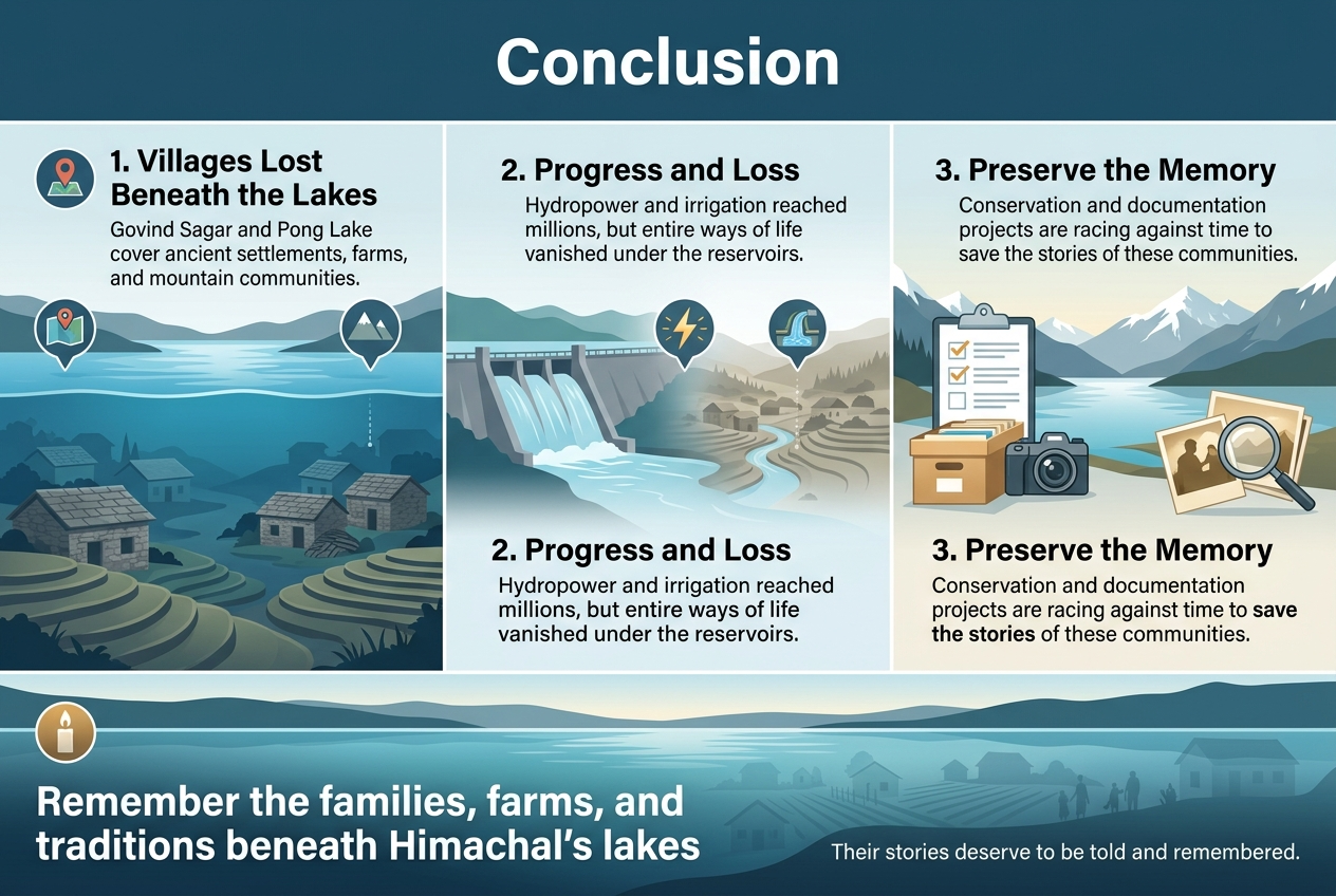
The submerged villages beneath Himachal's pristine lakes tell stories that go far deeper than the water that now covers them. From Bilaspur's ancient settlement at Govind Sagar to the agricultural communities lost beneath Pong Lake, these underwater ghost towns represent thousands of years of mountain life that vanished in the name of progress. Each dam project may have brought electricity and irrigation to millions, but it also erased entire ways of life that had thrived in these valleys for generations.
Today's conservation efforts and documentation projects are racing against time to preserve what memories remain of these lost communities. While you can't walk through these villages anymore, you can still visit the lakes above them and imagine the bustling life that once filled these valleys. Next time you're near one of Himachal's major reservoirs, take a moment to remember the families, farms, and traditions that now rest silently beneath the surface – their stories deserve to be told and remembered.
Post a Comment